Environmental sustainability has become one of the most important global priorities as communities, governments, and industries search for smarter ways to protect natural resources while supporting development. One of the most powerful tools driving this effort is Geographic Information System (GIS) technology. GIS has transformed how we understand the environment, monitor change, and make informed decisions that balance human needs with ecological protection.
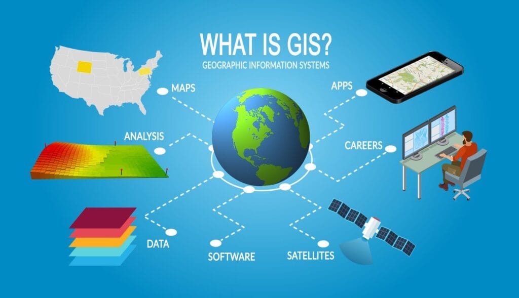
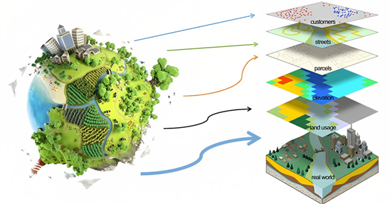
At its core, GIS is a system designed to capture, store, analyze, and visualize spatial and geographic data. What makes it particularly valuable for environmental sustainability is its ability to connect location-based data with real-world environmental conditions. Through maps, satellite imagery, and spatial analysis, GIS provides a clearer picture of how natural systems function and how human activities affect them.
One of the most significant contributions of GIS to environmental sustainability is its role in environmental monitoring. Forest cover, water bodies, air quality, soil conditions, and wildlife habitats can all be monitored over time using GIS tools. By comparing historical and current data, environmental experts can detect changes such as deforestation, land degradation, erosion, or pollution. This early detection allows authorities and environmental organizations to take timely action before damage becomes irreversible.
GIS also plays a critical role in land-use planning and sustainable development. As urban areas expand, unplanned development often leads to environmental degradation, flooding, loss of biodiversity, and resource depletion. GIS helps planners analyze land suitability by considering factors such as topography, soil type, drainage patterns, and existing infrastructure. With this information, governments and developers can make informed decisions that reduce environmental impact while supporting economic growth.
In climate change management, GIS has become an essential tool. It helps scientists model climate patterns, track rising sea levels, analyze temperature variations, and identify regions most vulnerable to climate-related hazards. These insights support disaster preparedness, risk assessment, and climate adaptation strategies. For example, GIS can be used to map flood-prone areas, helping authorities design better drainage systems and emergency response plans that save lives and property.
Natural resource management is another area where GIS proves invaluable. Whether managing forests, water resources, minerals, or agricultural land, GIS provides accurate data for sustainable use. In agriculture, GIS supports precision farming by helping farmers determine the best planting areas, irrigation needs, and soil management practices. This not only increases productivity but also reduces waste, chemical overuse, and environmental damage.
Biodiversity conservation also benefits greatly from GIS technology. By mapping wildlife habitats, migration routes, and protected areas, conservationists can identify threats to ecosystems and design effective conservation strategies. GIS enables the monitoring of endangered species and helps in planning wildlife corridors that reduce human-wildlife conflicts.
In urban environments, GIS supports the development of smart and sustainable cities. It assists in managing transportation networks, waste disposal systems, energy distribution, and green spaces. With accurate spatial data, city planners can reduce congestion, improve air quality, and create healthier living environments for residents.
Ultimately, GIS serves as a powerful decision-making tool that bridges science, technology, and sustainability. By providing accurate, real-time spatial information, it empowers governments, organizations, and communities to make informed choices that protect the environment while supporting long-term development goals. As environmental challenges continue to grow, the role of GIS in achieving sustainability will only become more essential.
Leave a Reply
You must be logged in to post a comment.