Geographic Information Systems and geospatial data have moved far beyond their early role as mapping tools. Today, they sit at the center of how governments, businesses, and communities understand space, risk, and opportunity. As technology advances and the demand for location-based insight grows, GIS is entering a new phase defined by deeper intelligence, faster analysis, and wider accessibility.
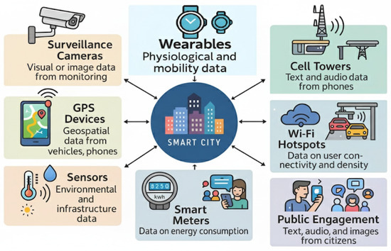
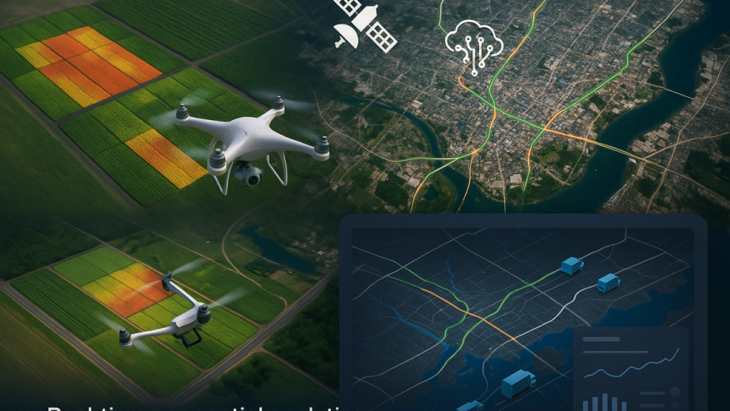
One of the most noticeable shifts is the increasing availability of real-time geospatial data. Sensors, satellites, mobile devices, and connected infrastructure now generate location data continuously. This steady flow allows decision-makers to monitor events as they unfold rather than relying on historical snapshots. From traffic management to environmental monitoring, real-time GIS supports faster responses and more adaptive planning, especially in rapidly changing environments.

The integration of GIS with advanced analytics is also shaping the future of the field. Geospatial data is no longer analyzed in isolation. It is being combined with economic data, social indicators, climate records, and operational datasets to create richer insights. This convergence allows organizations to move from simply understanding what is happening to anticipating what is likely to happen next. Predictive spatial analysis is becoming a critical tool for managing risk, optimizing resources, and planning long-term investments.
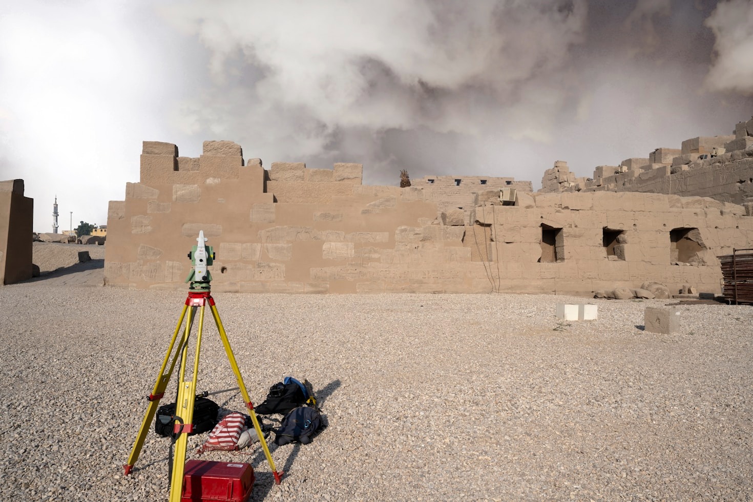
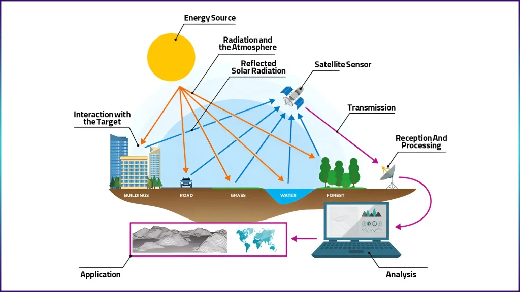
Another important trend is the growing role of high-resolution imagery and 3D spatial data. Advances in satellite technology, drone mapping, and LiDAR have made detailed elevation and surface models more accessible than ever before. These datasets enable more accurate simulations of terrain, infrastructure, and urban environments. As a result, planners and engineers can test scenarios digitally before implementing them on the ground, reducing errors and improving outcomes.
Cloud-based GIS platforms are also transforming how geospatial data is stored, shared, and used. Instead of working in isolated systems, teams can now collaborate across locations using centralized spatial databases. This shift supports better data governance, faster updates, and broader access to geospatial insights. As GIS becomes more collaborative, it moves closer to everyday business operations rather than remaining a specialized technical function.
The future of GIS is also closely tied to its expanding role in sustainability and resilience planning. Climate change, population growth, and resource pressure demand spatially informed solutions. Geospatial data helps identify vulnerable areas, track environmental change, and guide adaptation strategies. Whether planning flood defenses or managing land use, GIS provides the spatial context needed to make informed, responsible decisions.
Perhaps the most significant change ahead is the democratization of geospatial technology. Tools that once required specialized training are becoming more intuitive and accessible. This shift allows non-experts to engage with spatial data, ask meaningful questions, and gain insight without deep technical backgrounds. As more people gain access to geospatial tools, the impact of GIS will extend across more sectors and communities.
Looking ahead, GIS and geospatial data will continue to evolve from supportive tools into strategic assets. Organizations that understand these trends and invest in spatial thinking will be better prepared to navigate complexity, manage change, and uncover opportunities hidden in location. The future of geospatial intelligence belongs to those who recognize that every decision has a place, and every place tells a story.
As geospatial technologies continue to mature, the future of GIS is increasingly defined by how seamlessly spatial data fits into everyday decision-making. Location intelligence is no longer confined to technical departments or specialized projects. It is becoming embedded in business strategy, governance, and operational planning, influencing choices at every level.
One emerging direction is the stronger connection between GIS and digital twins. Cities, campuses, industrial facilities, and even natural systems are being replicated digitally using live geospatial data. These spatially accurate digital models allow planners and operators to test policies, infrastructure changes, and emergency responses in a virtual environment before applying them in the real world. As digital twins become more detailed and dynamic, GIS will act as the spatial backbone that keeps these systems accurate and relevant.
Interoperability is also shaping the future landscape of geospatial data. Organizations increasingly work with data from multiple sources, formats, and platforms. The push toward open standards and interoperable systems means geospatial information can flow more freely between applications. This reduces data silos and allows spatial insight to support a wider range of tools, from enterprise systems to public-facing platforms. As a result, GIS becomes less about where data lives and more about how effectively it is used.

Another important trend is the growing emphasis on data quality and trust. As reliance on geospatial data increases, so does the need for accuracy, consistency, and transparency. Metadata, validation processes, and version control are gaining importance, especially in sectors such as land administration, infrastructure development, and environmental regulation. Reliable geospatial data builds confidence among stakeholders and strengthens the credibility of decisions based on spatial analysis.
The role of GIS in economic planning and investment analysis is also expanding. Location-based insight is increasingly used to assess market potential, infrastructure readiness, and demographic trends. Investors and developers use spatial data to understand not just where opportunities exist, but why they exist. This spatial perspective adds depth to economic analysis and supports smarter, lower-risk investments.
Education and skills development will play a critical role in shaping the future of GIS. As demand for geospatial professionals grows, training is shifting toward practical, problem-solving skills that connect technology with real-world applications. At the same time, basic spatial literacy is becoming valuable across many professions. This broader understanding of space and location helps organizations communicate insights more effectively and collaborate across disciplines.
Ultimately, the future of GIS and geospatial data is about relevance. The technology will continue to evolve, but its true value lies in its ability to answer meaningful questions about people, places, and change. As spatial data becomes more integrated into daily workflows, GIS will move from the background into the center of decision-making, guiding actions that shape cities, industries, and environments for years to come.
Leave a Reply
You must be logged in to post a comment.